Fallen Leaf Lake Directions

Fallen Leaf Lake, CA

Fallen Leaf Lake Directions


Map showing the greater Fallen Leaf Lake area, CA

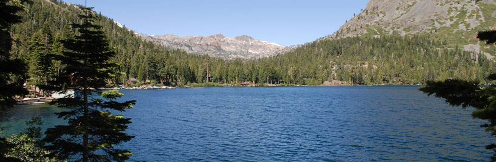
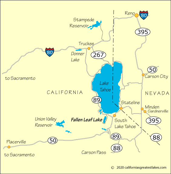
Getting to Fallen Leaf Lake

Fallen Leaf Lake lies off Highway 89 at the southwestern corner of Lake Tahoe. From Interstate 80 turn south on Highway 89 and follow it along the shore Lake Tahoe, past Emerald Bay. Watch for the sign for Fallen Left Lake on the right.

From Highway 50 at the Y in South Lake Tahoe, turn north on Highway 89. Near Camp Richardson, watch for the sign to Fallen Leaf Lake on your left.

Mileage and Driving Times to Fallen Leaf Lake
Miles Hours Mins.
Fresno 279 5 31
Los Banos 230 4 32
Merced 119 4 23
Modesto 178 3 46
Reno, NV 73 2 51
Sacramento 109 2 44
San Jose 229 4 25
Stockton 154 3 24


California's Best Camping

Lake Tahoe     Donner Lake     Eldorado National Forest
And all up and down California

California's Best Camping website logo